Measurable geospatial decision support using InSAR, LiDAR, photogrammetry and artificial intelligence
GeoPlato develops technical solutions for ground deformation, landslides, infrastructure stability and multi-hazard risk analysis. By integrating satellite SAR time series, image processing, LiDAR, photogrammetry, field measurements and engineering data within the same analytical framework, GeoPlato transforms monitoring, risk prioritization, reporting and damage assessment processes into actionable decision-support outputs.
Our Services
Satellite-Based Deformation Monitoring
Millimetric deformation analysis using InSAR time series for landslides, subsidence (sinkholes), mining areas, dams, highways, railways and major infrastructure corridors.
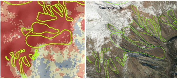
Landslide and Natural Hazard Analysis
Multi-hazard assessment, susceptibility and hazard mapping, early warning thresholds and prioritization outputs for landslides, earthquakes, floods, sinkholes and avalanches.
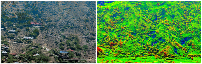
LiDAR and Photogrammetry
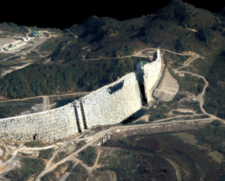
UAV, LiDAR and image-based 3D terrain analysis, topographic modelling, volume change detection, rock mass analysis and deformation assessment.
Decision Support Systems
Web-based monitoring dashboards, tailored gepspatial and AI analyses, digital twins, time-series analysis, alarm thresholds and visual reporting tools.
Why GeoPlato?
GeoPlato combines R&D expertise in remote sensing, photogrammetry, InSAR, LiDAR, artificial intelligence and geospatial software development with practical engineering, infrastructure monitoring and disaster management applications.
Field and Project Experience
Operational experience gained from completed InSAR deformation, landslide monitoring, LiDAR and infrastructure stability projects.
Scientific Expertise
A remote sensing and engineering approach supported by scientific publications, technical reports and validated methodologies.
Software Development Capability
Ability to deliver analysis results not only as reports, but also as web-based monitoring dashboards and decision support platforms.
Technical Outputs We Produce
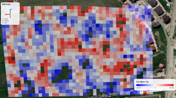
InSAR Velocity Maps
Mapping deformation velocities and cumulative displacements using satellite SAR datasets.
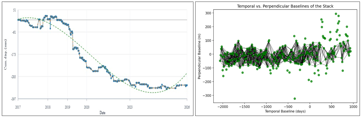
InSAR Time-Series Analysis
Location-based deformation time-series analysis and monitoring.
Risk and Susceptibility Maps
Generation of hazard and susceptibility maps for landslides, rockfall, sinkholes, liquefaction, avalanches, floods and earthquakes.
LiDAR-based 3D Models
3D analysis and terrain modelling using UAV and satellite LiDAR datasets.
Infrastructure Stability Analysis
Stability assessment and monitoring using multi-platform and multi-sensor datasets.
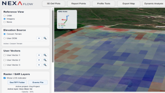
Web Monitoring Dashboards
Web-based user access and customized analytical interfaces.
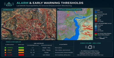
Alarm and Early Warning Thresholds
Site-specific alarm and early warning thresholds for natural hazard monitoring systems.

Technical Reports
Integrated reporting for natural hazards, photogrammetry, LiDAR and InSAR analyses.
Scientific and technical background
GeoPlato’s technical approach is built upon scientific publications, field projects, remote sensing-based engineering applications and software development experience.